Stockholm World Water Week 2024 Session Outcome Report “Accountability for Enhanced Ecosystem Security and Water Resilience in Asia-Pacific”
Stockholm 2024 Asia-Pacific Focus Sessions
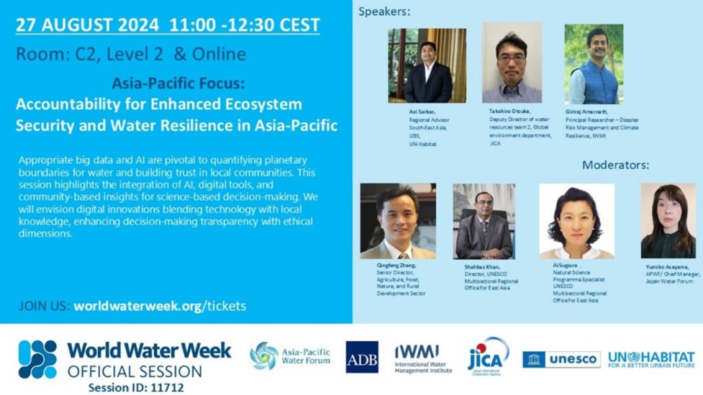
27 August (Tues) 11:00-12:30 CEST
Convenors – APWF, UNESCO Beijing, IWMI, JICA, UN-HABITAT, ADB
Session Overview
Appropriate big data and AI are pivotal to quantifying planetary boundaries for water and building trust in local communities. This session highlights the integration of AI, digital tools, and community-based insights for science-based decision-making. This session envisioned digital innovations blending technology with local knowledge, enhancing decision-making transparency with ethical dimensions.
Presentation
Five presenters highlighted the role of digital technologies, community engagement, and scientific data in addressing water and ecosystem challenges in the presentation part. Data-driven decision-making, stakeholder collaboration, and innovative sustainable water management approaches were their key focuses.
Dr. Avi Sarkar, Regional Advisor – Southeast Asia, UBS | Head of Office, Lao PDR, UN-HABITAT presented “Echoes of Innovation: Synergizing Digital Technologies & Community Voices for Resilient Water and Ecosystem Security.” He highlighted efforts to enhance water and ecosystem resilience in Lao PDR by integrating digital tools with community input.
In Lao PDR, about 46% of settlements are affected annually by climatic hazards, mainly floods and droughts. These hazards have a significant economic impact, with floods alone projected to reduce GDP by 3.6%. An analysis conducted by UN-Habitat in partnership with the Ministry of Natural Resources and Environment identifies settlements most prone to hazards.
The UN-HABITAT Lao PDR’s initiative, operating in 7 provinces and 12 districts, takes a comprehensive approach to address the challenges. It focuses on community consultations to validate data and integrate local perceptions into vulnerability assessments. Community participation is central to action planning, capacity building, and infrastructure solutions. Climate vulnerability assessments are conducted at various scales, from small settlements to large cities. Data is collected using tools, group discussions, stakeholder consultations, and secondary data such as census and hydrological records. This data feeds into town-level master plans and settlement-level action plans prioritizing infrastructure needs.
The initiative supports small and large water supply systems and wetlands restoration in cities. Capacity building is streamlined across national, subnational, and community levels. Training programs for government officials focus on in-depth technical knowledge, while communities are trained on vulnerability assessments and urban planning basics. Wetlands restoration covers 1,500 hectares, and water supply systems aim to serve 200,000 people by 2025.
A key impact of the initiative is the shift in urban and settlement planning, promoting an integrated approach that considers climate change and fosters inter-departmental collaboration. The initiative’s long-term vision is to build resilience through capacity building at multiple levels, with communities playing a critical role in the process.
This effort demonstrates integrating digital technology with local knowledge to address climate vulnerabilities, enhance infrastructure resilience, and build sustainable, water-secure communities.
Dr. Takahiro OTSUKA, Deputy Director of Water Resources team 2, Global Environment Department, JICA, introduced the use of digital innovation, particularly satellite data, to build consensus and enable transparent decision-making to address land subsidence in Jakarta through a JICA Technical Cooperation project.
Land subsidence, caused by excessive groundwater extraction, is a significant issue in large cities like Jakarta. The situation is severe in coastal areas where parts of northern Jakarta are below sea level, resulting in frequent flooding and abandoned infrastructure.
In response to Jakarta’s crisis, a cooperation project between Japan and Indonesia was initiated to transfer knowledge from Tokyo’s success and adapt it to Jakarta’s needs. The project emphasizes knowledge co-creation, ensuring Indonesian government officers are fully engaged, and decisions are rooted in scientific evidence.
Satellite technology, specifically Synthetic Aperture Radar (SAR) with L-band wavelength, was used to monitor land subsidence across wide areas. By comparing data from different years (2007-2010 and 2014-2017), subsidence patterns were identified, with the most affected areas highlighted in red and yellow. Combining satellite data with ground surveys helped pinpoint critical areas where groundwater withdrawal is causing the most subsidence.
Before the project, stakeholders in Jakarta lacked consensus on the causes of subsidence, impeding serious action. Japan’s experience in reducing groundwater pumping and introducing alternative water resources, shared through seminars, helped raise awareness among policymakers. Integrating wide-area satellite analysis and on-ground data allowed for precise identification of subsidence hotspots, facilitating informed discussions and coordinated countermeasures among stakeholders.
Scientific data has been essential in fostering transparent decision-making and building consensus for effective solutions. Jakarta’s efforts to combat land subsidence continue, supported by satellite technology, which is critical in monitoring, planning, and implementing countermeasures. Using satellite data and scientific analysis is crucial in addressing land subsidence, fostering stakeholder collaboration, and enabling informed, transparent decision-making in Jakarta.
Dr. Giriraj Amarnath, Principal Researcher – Disaster Risk Management and Climate Resilience, IWMI The presentation “No Water, No Security: The Imperative of Ecosystem & Water Resilience” highlights the complexities of water availability. Some regions face water abundance while others face scarcity at different times and scales. Effective water management requires robust data, particularly hydrometeorological data, essential for climate adaptation and mitigation efforts. The decline in such data collection systems undermines resilience and development goals.
A key aspect discussed is the importance of comprehensive water accounting frameworks, from continental to subnational and catchment levels. For example, the IWMI developed a continental water accounting framework that was applied to large river basins in Africa, which helps quantify water use for agriculture, domestic, and industrial needs. This data informs national planning and is critical for future climate scenarios and ecosystem services, especially in the nexus of water, energy, food, and livelihood security.
He also emphasized environmental flow (E-flows) modeling, illustrated by studies on the Ganges River. This framework analyzes how human activities alter water and offers insights into balancing water for ecosystem services like flood prevention and water purification. Furthermore, catchment resilience indices were introduced, incorporating stakeholder input and risk assessments to prioritize interventions and investments, particularly in upstream areas often neglected in favor of downstream water concerns.
He stressed the need for cross-scale and multi-scale approaches, institutional cooperation, and science-based solutions to ensure that investments in water resilience are appropriately targeted and contribute to ecosystem sustainability and human security.
Mr.Qingfeng Zhang, Senior Director of Agriculture, Food, Nature, and Rural Development Sector Office, ADB,presented “Natural Capital Assessments to Address the Climate-Food-Nature Nexus” . He emphasized the importance of assessing natural capital to tackle the interconnected challenges of climate change, food insecurity, and nature loss in the Asia-Pacific region.
Key initiatives by the ADB and other multilateral development banks (MDBs) include mainstreaming natural capital into their operations. ADB has introduced natural capital frameworks, including regulatory systems such as payment for ecosystem services (PES) and natural capital accounting. They have also launched the Asia-Pacific Natural Capital Fund, with initial investments of $50 million from the Global Environmental Facility and the Global Agriculture and Food Security Program, aiming to scale up investments in natural capital.
In partnership with organizations like the Inter-American Development Bank and the World Bank, ADB is engaging 15 countries in natural capital accounting, with a focus on water services and watershed management. The “Invest” tool, developed in collaboration with Stanford University, is one key tool for modeling ecosystem services and assessing the value of natural capital through remote sensing, surveys, and environmental monitoring.
ADB is also implementing nature-based solutions (NbS), exemplified by projects like the Yangtze River ecosystem restoration, which integrates upstream and downstream stakeholders to enhance freshwater, wetland restoration, sustainable agricultural practices, and climate-resilient infrastructure. The eco-compensation and PES mechanisms are central to ADB’s strategy for sharing costs and benefits between upstream and downstream users.
He concluded with an example of a seasonal water modeling tool used in collaboration with Stanford University. This tool helps assess ecological flows by analyzing rainfall patterns, groundwater recharge, and sustained water availability for ecosystems. This model is critical for river basin management, especially in areas facing land degradation and water security challenges. The overall goal is to improve natural capital investments and address the urgent need for sustainable climate, food, and nature nexus management.
Prof. Sharbaz Khan, the director of UNESCO, the regional office for East Asia, and the representative of China, ROK, Japan, and DPRK, highlighted UNESCO’s role in promoting open science, integrated water resource management (IWRM) through Accountable Data and Information.
The “spiral approach” to IWRM, developed in collaboration with NARBO and UNESCO Category II centers, emphasizes the growing importance of data, models, and decision support systems. Key steps to achieve SDG 6 include data collection, capacity building, innovation, governance, and financing. Examples from Shenzhen, China, show how AI and digital twin technology connect over 55,300 water facilities in real-time for smarter decision-making, while UNESCO leverages satellite tech for water disaster management along the Belt and Road Initiative.
Challenges remain in water data quality, including precipitation, groundwater, river flows, and ethical concerns over data ownership. UNESCO’s 2021 Open Science Initiative addresses digital divides, providing access to science and technology, supporting transboundary water management, and engaging stakeholders. In the Asia-Pacific, Open Science is gaining momentum, and updated guidelines specific to IWRM may be necessary.
AI plays a key role, especially in managing transboundary water data and filling gaps where data is sparse. UNESCO is advancing open science, open data, and AI, with AI helping develop biophysical models and generating source codes. He emphasized the need for responsible water management, fostering open dialogue, and promoting integrated solutions to address water security and disaster management as part of the SDG goals.
Panel discussion- Question from the audience
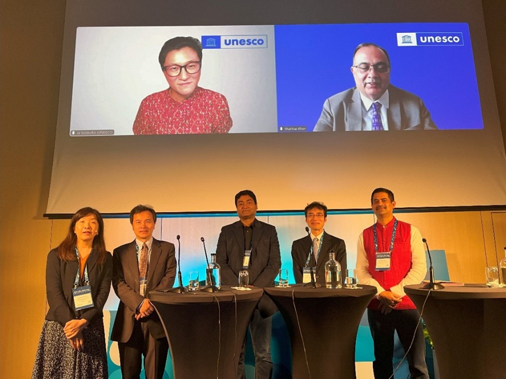
Dr. Ai Sugiura, Natural Science Program Officer, UNESCO Beijing, conducted online moderator and Ms. Yumiko Asayama conducted onsite moderator’s role during the panel discussion. Firstly, we had the interaction with audience through the Q&A.
Q1: I’m curious about the existing global or cross-continental mechanisms for sharing and developing river basin management plans, particularly in areas where they are needed. How are these plans being shared to serve as a foundation for other water-related investments, such as WASH initiatives, to build upon?
- Dr. Qingfeng Zhang, ADB, responded that we actively engage with a network of Asia-Pacific river basin organizations (NARBO). One of our key initiatives is revitalizing the NARBO at the 10th World Water Forum in Bali, which serves as an example of how we collaborate with river basin organizations to share their experiences.
- Prof. Shahbaz Khan, UNESCO, also answered that we gathered river basin plans and best practices from regions and worldwide when we developed the integrated river basin management guidelines. These guidelines include a critical concept known as “keys for success.” For example, plans like the Murray-Darling Basin Plan, those from the Indus River, or rivers in India and Bangladesh reflect how different challenges were addressed and how the spiral approach was adopted. While this information has been valuable, some is becoming outdated and needs updating.. ADB and NARBO have played a crucial role in the Asia-Pacific region by promoting and building the capacity of river basin organizations. NARBO focuses on strengthening networks and capacity building. However, in many countries, river basin organizations are still lacking, and water management continues in traditional ways. UNESCO and the Global Water Partnership have been pivotal in building the capacity of water managers by introducing key concepts and modern approaches. Many of the plans and case studies already exist. It’s time to reassess their relevance, ensure they are up-to-date, and incorporate new tools, technologies, methodologies, and paradigms.
- Dr. Giriraj Amarnath, IWMI, also responded to the question. Over the past four to five years, IWMI has successfully harmonized and consolidated global basin models, making them open-source and accessible to any institution. In addition, IWMI has recently completed around 11 publications on river basin management, which are available as books. At the UN level, a forum is held every two years where river basin organizations gather to discuss current gaps and challenges. These forums offer valuable insights, but I agree that there is no harmonized global framework for comprehensively reviewing and addressing these issues. While some river basins have achieved socio-political commitments, most face significant challenges related to transboundary cooperation, which remains a persistent and complex problem worldwide.
Q2: Could you explain what types of climate-resilient water infrastructure will be implemented to address the frequent floods and droughts in Lao PDR?
Dr. Avi Sarkar, UN-HABITAT: We have worked in 191 settlements, completing projects in 189, with tailored technological solutions depending on the area’s needs. For instance, ram pumps are used where electricity is unavailable, while gravity-fed systems are applied elsewhere. A key focus is ensuring communities can sustainably maintain their water systems, with attention to governance and operations. A major challenge is infrastructure failure within 6-8 months in some remote areas of Laos. To address this, we’ve partnered with local water utilities for technical expertise, recognizing that while community-based approaches are valuable, they often require institutional support for long-term success. Combining governance, technology, and institutional backing is essential to meet community needs effectively.
Q3: I have a research background in transboundary river management in Central Asia. My question revolves around political relationships, trust in transboundary water systems, and the need for open data. In many transboundary river contexts, the control and availability of data are often used to maintain the status quo, which can hinder trust between states. Yet, trust is crucial for encouraging states to share transboundary river data. How do we bridge the gap between the scientific and data-driven need for transboundary cooperation and the political realities that often impede data sharing? How can we increase political will to promote action based on facts and data-driven insights for transboundary river management?
- Answer from Dr. Sharbaz Khan, UNESCO: Similar to the challenges faced by rivers such as the Amu Darya, many other river systems across Asia and Africa, including transboundary aquifers, face significant data-related issues. It becomes especially critical in emergency situations where real-time information is essential, as hydrographs develop rapidly and can cause devastating impacts. A major obstacle is the lack of trust between nations, which remains a significant barrier.
It is why “water diplomacy,” “hydro diplomacy,” and “science diplomacy” are so important. Organizations such as the United Nations’ Intergovernmental Hydrological Program (IHP), the World Meteorological Organization (WMO), financial institutions like ADB, and platforms like the Asia-Pacific Water Forum have been working tirelessly to foster consensus and cooperation. However, we must acknowledge that we haven’t fully reached our goals yet.
One positive development, though, is the growing role of remote sensing. For example, tools like GpsMap developed by JAXA (Japan Aerospace Exploration Agency) provide critical insights into precipitation patterns, especially in regions that are otherwise inaccessible for ground-based measurements. As our colleagues from the IWMI have highlighted, these satellite technologies and large-scale models are helping to bridge the data gaps we face in disaster risk reduction and flood management.
Trust-building efforts between nations must persist, especially after recent events like the floods in Bangladesh, where the emerging narratives have not necessarily fostered trust. We must base cooperation on transparent data and facts. UNESCO’s work on combating misinformation, the role of media, and promoting intercultural dialogue is also vital in this regard. There is no easy solution to these challenges, but strengthening subregional mechanisms—whether in Central Asia, Southeast Asia, or South Asia—is a step forward. We must continue working toward a future built on trust, cooperation, and shared responsibility for both our people and ecosystems.
- Dr. Otsuka JICA highlighted the importance of trust when it comes to data. Scientific data, while essential, can sometimes be used for political purposes, which can complicate matters. Therefore, scientific data alone is not enough. It must be coupled with efforts to build consensus among stakeholders. The key question is how we gather and present scientific data and ensure a shared understanding of it. Reaching a common understanding is critical, and we must carefully consider how scientific data is communicated and utilized to foster trust and cooperation.
Q4: The challenges in securing national funding for ecosystem restoration projects in South and Southeast Asia, where international support is currently the primary source of funding. Through his experience, particularly in Thailand, noting that restoration projects require strong metrics and evidence-based justification to demonstrate their benefits. However, it is often difficult to present and defend these projects to finance departments, leading to restoration being deprioritized in favor of infrastructure projects like irrigation. He seeks advice on securing national funding and sustaining long-term implementation of restoration efforts in the region.
- Dr. Qingfeng Zhang, ADB, highlighted the importance of valuing nature, particularly water, through regulatory changes and natural capital accounting in countries ADB has implemented in China, Vietnam, and the Philippines. The recent Natural Capital Accounting Act in the Philippines allows the government to assess the value of natural resources better, making it easier to introduce water tariffs and finance water services. The link between natural capital and biodiversity conservation is also emphasized, with initiatives like UK biodiversity credits encouraging investment in ecosystem restoration. The San Miguel Corporation in the Philippines is an example of a company investing in watershed services supported by biodiversity credits. Regulatory changes and natural capital accounting are essential tools for investing in nature-based solutions.
- Dr. Sharbaz Khan, UNESCO: The biggest challenge is financing, as countries must significantly increase investments across multiple levels. At the same time, the role of businesses in safeguarding the environment and ecosystems is becoming increasingly important. Everyone has a role to play. Moreover, the SDGs related to water are far off track, and a key issue is how to implement the right financing mechanisms to address what is urgently needed.
Panel Discussion through the question from Dr. Ai Sugiura, online moderator
1. Question to Dr. Qinfeng Zhang, ADB:- Some insights on the integration of economic services modeling and economic valuation to lead more sustainable water management practices.
Answer: The Yangtze River case demonstrates the importance of natural capital and its integration with China’s National Development and Reform Commission through an eco-compensation scheme. The “Grain for Green” program initially compensated farmers for shifting from steep-slope farming to wetland restoration. Progress was later measured using natural capital accounting, specifically the Gross Ecosystem Product (GEP), which led to a pay-for-performance model. The Asia Pacific Natural Capital Lab is now collaborating with several countries to update ecological service payment frameworks. New tools like biodiversity credit schemes are being introduced to integrate nature into decision-making processes.
2. Question to Dr. Avi Sarkar, UN-HABITAT: We’ve heard about the critical role of community engagement and the involvement of local communities. Could you share some of the key challenges you’ve encountered during this process, particularly in working with local communities, from data collection to validation? Additionally, how were these challenges addressed and overcome?
Answer: We didn’t face significant challenges in community engagement. While financial constraints could have been an issue, communities were eager to participate when they saw meaningful involvement. Initial reluctance gave way to active engagement once the benefits, such as improved water provision, became clear. The experience has been positive, with community insights often aligning with
3: Question to Dr. Giriraj Amarnath, IWMI “Did you encounter any challenges while engaging with local communities in your project, and what specific impacts did their involvement have?”
Answer: One main challenge we face is the project’s exit strategy. Communities often struggle when we transition through different phases of the project. Although we involve them early on, surveys show that their involvement tends to be limited to the later stages of implementation. This leads to difficulties when programs or schemes are handed over. For example, in water user associations, schemes that are maintained and operated by the government can be challenging for communities to sustain once handed over. Their needs often differ from those anticipated by government-led initiatives. To address these challenges, it’s crucial to emphasize a co-design approach from the start. In addition, delays in land allocation, clearance, and environmental impact assessments can impact the overall project lifecycle and its effectiveness.
4. Question to Dr. Takahiro Otsuka, JICA: How does your project promote countermeasures against land subsidence in Jakarta, highlighting the importance of policy reform and inter-institutional collaboration? In addition to building consensus with local communities, these elements play a crucial role in successfully implementing and advancing such measures.
Answer: Combining challenges with effective communication with communities is crucial. While scientific analysis can be straightforward, implementing solutions can be difficult, particularly in Jakarta’s case of land subsidence. For example, identifying critical areas is one thing, but addressing issues like excessive groundwater use by factories requires more. Regulation of groundwater use is necessary, but this requires consensus-building among stakeholders and community understanding. Effective consensus-building relies on precise scientific data, including both satellite and ground-based data, such as actual groundwater withdrawal amounts. This evidence helps in understanding the current situation and building a shared understanding. Policy reform and institutional collaboration are also vital, as multiple ministries are involved, and achieving a common understanding among them is essential.
5 Question to Dr. Sharbaz Khan, UNESCO: What are the key ethical considerations when implementing digital water management solutions, and how can we balance these challenges with principles of open science and other approaches?
Answer. The increasing use of digital tools like AI in water management brings growing challenges, including data handling, AI training, biases, and community trust. Jakarta’s land subsidence issue illustrates these concerns, highlighting the need to carefully consider perspectives, analysis, and economic impacts. Ethical issues, property rights, and social media influence and misinformation further complicate the situation. Addressing these challenges requires collaboration among ethicists, economists, and policymakers, focusing on local context and sensitivity.
Session Wrap up
Dr. Dr. Ai Sugiura, Natural Science Program Officer, UNESCO Beijing, wrapped up this session. Using recent innovative technologies, we discussed enhancing ecosystem security and water resilience in Asia and the Pacific. We emphasized incorporating local knowledge, data literacy, and community engagement into decision-making processes. Effective water management requires a multisectoral approach involving government, academia, civil society, and the private sector. Building the capacity to understand, translate, and accept data is crucial. We also highlighted the need for evidence-based communication in policy-making and investment and the importance of trust and accountability. We also discussed ethical considerations, open science, and adaptive management, focusing on ensuring sustainability and securing policy and institutional support. Global standards and recommendations, such as those from the UN, can assist in these efforts, but there is still much work to be done collaboratively.
Program
Session Introduction Yumiko Asayama, Chief Manager, APWF Sec/ Japan Water Forum
Presentation
Echoes of Innovation: Synergizing Digital Technologies & Community Voices for Resilient Water and Ecosystem Security
Dr. Avi Sarkar, Regional Advisor – South-East Asia, UBS | Head of Office, Lao PDR UN-HABITATA case of digital innovation combining technology and local knowledge for consensus building & decision making: A Japan-Indonesia collaborative project to reduce subsidence in Jakarta, Indonesia
Dr. Takahiro OTSUKA, Deputy Director of water resources team 2, Global environment department, JICANo Water, No Security: The Imperative of Ecosystem & Water Resilience Dr. Giriraj Amarnath, Principal Researcher – Disaster Risk Management and Climate Resilience, IWMI
Natural Capital Assessments to address the Climate-Food-Nature nexus Mr. Qingfeng Zhang, Senior Director, Agriculture, Food, Nature, and Rural Development Sector Office, ADB
Open Science: Enhancing Water Management through Accountable Data and Information Dr. Sharbaz Khan, Director of UNESCO, Regional Office for East Asia and Representative to China, ROK, Japan, and DPRK.
Panel Discussion, including interaction with the audience
Online Moderator- Dr. Ai Sugiura, Natural Science program Officer, UNESCO Beijing Onsite Moderator: Ms. Yumiko Asayama Panelists: The above presentersWrap Up
Dr. Ai Sugiura, Natural Science program Officer, UNESCO Beijing
(Reporter Ms. Yumiko Asayama, APWF Secretariat)