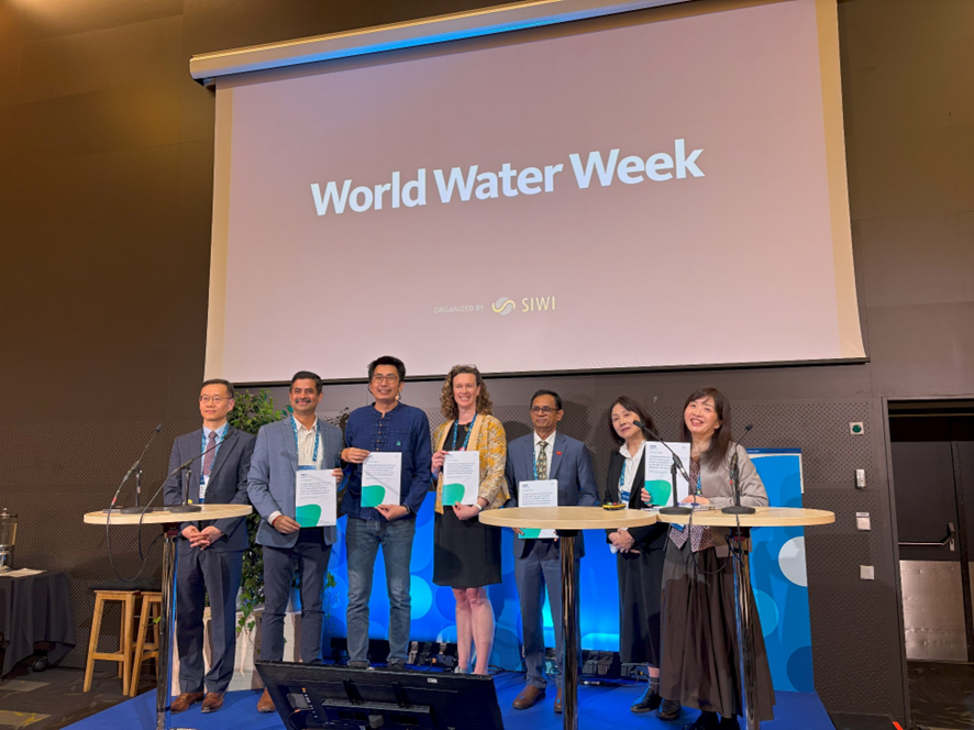
Session Outcome Report: Stockholm World Water Week 2025, Asia-Pacific Focus—Early Warnings in Asia-Pacific
Bridging Science with Action
Date: 27 August 2025 9:00-10:30 (CEST)
The recording is available via YouTube:
Session Overview
Ms. Yumiko Asayama, Chief Manager of the APWF Secretariat / Japan Water Forum, introduced the session objectives. The session focused on closing gaps in early warning systems through science, technology, and governance innovations, featuring two panels on (1) Science, Technology, Data, and Space Applications, and (2) Communication, Governance, Community Engagement, and Investment. Speakers from WMO, IWMI, ADPC, JAXA, KEI, ICIMOD, and AWP shared insights on advancing inclusive, gender-responsive, and anticipatory early warning systems that ensure no one is left behind. She emphasized the importance of strong governance, cross-sectoral collaboration, inclusive engagement, and targeted investment at the last mile to achieve this goal.
Keynote Presentation
Dr. Stefan Uhlenbrook (WMO) highlighted progress under the EW4All initiative, emphasizing global and regional advances in risk knowledge and multi-hazard early warning systems (MHEWS).
Global progress:
- 55 countries have developed disaster risk information systems.
- 108 countries have strengthened MHEWS capacities.
- 45 countries now use cell broadcast technology for warning dissemination.
- The number of anticipatory action frameworks doubled between 2022 and 2023.
Asia–Pacific progress:
- The region has achieved significant reductions in disaster-related fatalities, though exposure and vulnerability remain high.
- Major hazards in 2024 included extreme heat, cyclones, floods, landslides, and severe winter conditions.
- Nearly all 30 priority countries have completed national consultations, developed roadmaps, and begun implementation.
- The region performs above the global average in risk knowledge, yet gaps persist in forecasting, communication, and preparedness.
Dr. Uhlenbrook concluded that while progress is tangible, further action is required to make systems fully inclusive and accessible to all populations.
Part 1: Science, Technology, Data, and Space Applications – Presentations and Discussion
Presentation
Dr. Giriraj Amarnath (IWMI)
Dr. Amarnath emphasized the importance of linking early warning, early action, and early finance to strengthen disaster resilience. With climate extremes intensifying by ~7% for every 1°C rise in temperature, he called for urgent, collective, and coordinated action.
He presented IWMI’s work with national hydrometeorological agencies to develop trigger-based systems and dashboards for multiple hazards, co-designed with local authorities and humanitarian organizations. Once approved, district officers can activate pre-arranged financing for interventions—such as canal restoration or school safety upgrades—before disasters occur.
He underscored the “no regrets” principle: early finance should build resilience even if a disaster does not occur. Data integration through open API standards is also advancing to connect diverse datasets (biophysical, nutrition, food price, displacement, etc.).
Evidence from 11 countries, including Sri Lanka, demonstrates success through locally led interventions (e.g., canal restoration, tree planting, SMS alerts). Dr. Amarnath identified gender and social inclusion as the next frontier, urging continued collaboration to translate global EW4All momentum into practical, inclusive action.
Dr. Senaka Basnayake (ADPC)
Dr. Basnayake presented ADPC’s four-decade experience in strengthening early warning systems across the Asia-Pacific.
- Under Pillar 1 (Risk Knowledge): National-to-city-level risk assessments integrate hazard, exposure, and vulnerability data for future scenarios.
- Pillar 2 (Forecasting): Tools like Diana and WRF enhance visualization and modeling (e.g., in Myanmar).
- Pillar 3 (Dissemination): A storm tracker covers the Indian Ocean and South China Sea with regular bulletins.
- Pillar 4 (Preparedness): ADPC advances community readiness through drills, shelters, and simulations.
Recent work integrates Impact-Based Forecasting in Cambodia, Lao PDR, and Vietnam, linking color-coded risk levels to recommended actions. Dr. Basnayake concluded that ADPC’s integrated approach translates scientific data into practical actions that save lives.
Dr. Riko Oki (JAXA)
Dr. Oki showcased JAXA’s satellite-based tools supporting early warning systems:
1.GSMaP – Global Satellite Mapping of Precipitation
- Provides near real-time rainfall estimates every hour at 10 km resolution.
- Used by over 160 countries, supporting rainfall monitoring and extreme event analysis.
- Contributes to WMO’s Space-based Weather and Climate Extremes Monitoring Project.
2.Today’s Earth – Hydrological Simulation System
- Simulates global land surface hydrology and river forecasts.
- Successfully predicted over 90% of flooded areas during Japan’s Typhoon Hagibis (2019).
- Aims to achieve 1 km resolution for municipal-level monitoring.
All JAXA satellite data are freely available, reinforcing open access and collaboration to strengthen early warning capabilities.
Panel 1 Discussion – Science, Technology, Data, and Space Applications
Moderator: Dr. Leila Salarpour (UNESCAP)
Panel 1 focused on integrating top-down forecasts with local knowledge, leveraging satellite and Earth observation tools, and utilizing digital innovation to operationalize multi-hazard early warning systems (EWS).
Dr. Salarpour, UNESCAP emphasized the importance of cross-sector and international partnerships in strengthening early warning capacities and bridging the gaps between science and local action.
Dr. Giriraj Amarnath (IWMI) highlighted how digital tools and impact-based forecasting in Sri Lanka are improving coordination between the irrigation, health, and water sectors, enabling proactive measures such as dengue prediction and adaptive reservoir management.
Dr. Senaka Basnayake (ADPC) emphasized the need to transition from donor-driven, project-based EWS to institutionalized systems under national leadership, citing Cambodia as an emerging example through the EW4All initiative.
Dr. Riko Oki (JAXA) showcased freely available satellite products, such as GSMaP and Today’s Earth, and underscored the importance of co-developing “action-ready” information with end-users.
The Panel 1 discussion concluded that sustained institutional engagement, policy coherence, and user-centered innovation are key to making early warning systems more inclusive, actionable, and sustainable across the region.
Part 2: Communication, Governance, Community Engagement, and Investment
Moderator: Dr. Thanapon Piman (SEI Asia)
Panel 2 focused on strategies for effectively communicating early warning information and engaging communities, particularly in rural, remote, and marginalized areas. Discussions underscored the importance of locally led approaches, inclusive messaging, and trust-building to ensure that warnings are actionable and reach those most vulnerable.
Presentations
Ms. Sarah Ransom (Australia Water Partnership, AWP) presented the Pacific Early Warning Systems Project, which is being implemented in collaboration with the Secretariat of the Pacific Community (SPC) and Alluvium Australia. The initiative strengthens flash flood early warning systems in Fiji, Samoa, Solomon Islands, and Vanuatu by combining technical components—such as stream gauging and hydrology capacity development—with inclusive community engagement.
Key findings emphasized:
- The need for simplified flood maps, warnings in multiple languages, and sufficient lead time for vulnerable groups.
- The value of community input in providing localized information.
- The importance of linking technical data with local interpretation to make warnings actionable.
Ms. Ransom emphasized that social inclusion was integral to the project’s design, ensuring the participation of women, persons with disabilities, and other vulnerable groups.
Dr. Ik Jae Kim (Korea Environment Institute, KEI) shared Korea’s progress in integrated water management, emphasizing its rapidly expanding flood monitoring and warning network, which now covers 220 sites with alerts delivered directly to drivers via GPS systems.
Advances in AI, satellite technology, and modeling have extended flood warning lead times from three hours toward a two-day target. Korea’s Water Data Hub, launched in April 2024, integrates 36 data types—including hydrology, water quality, and ecosystem data—with a planned expansion to be complete by 2027.
Key challenges include urban inundation, rising temperatures affecting water treatment facilities, and the need for data integration. To address these, Korea is strengthening science–policy interfaces and stakeholder engagement to enhance climate resilience and water security.
Dr. Saswata Sanyal (ICIMOD) presented the Community-Based Flood Early Warning System (CB-FEWS) approach, emphasizing sustainability as a fifth pillar alongside the traditional four pillars of early warning systems. CB-FEWS promotes people-centered, community-responsive solutions, where local leaders maintain systems through a community fund mechanism.
Key elements include:
- Risk Knowledge: Communities assess local flood risks.
- Detection and Forecasting: Local caretakers monitor sensors.
- Communication and Dissemination: Local governments manage alerts with technical support.
- Preparedness and Response: Gamification tools strengthen community readiness.
Integration with Earth Observation tools, such as the High Impact Weather Assessment Tool (HIWAT), extends lead times from 3–4 hours to up to two days. CB-FEWS links upstream and downstream communities across borders.
Notably, a 2017 Nepal–India case study showed how community warnings via sirens, SMS, and WhatsApp saved lives during transboundary floods.
Dr. Giriraj Amarnath (IWMI) presented the role of Gender Equality and Social Inclusion (GESI) within the EW4All initiative, linking it with Local Level Action (LLA) efforts. IWMI’s framework—developed through three years of research across multiple countries—identifies how disadvantaged and disabled groups can better access and act on early warnings.
The approach includes:
- Vulnerability assessments using Community Risk Assessment Guidelines.
- Identification of local priorities for early warning, action, and finance.
- Institutional analysis and guideline development to integrate inclusion into EW4All.
Pilot projects highlighted the importance of:
- Addressing inequalities beyond information provision.
- Conducting dynamic social analyses to capture evolving vulnerabilities.
Allocating pre-arranged budgets for proactive financing and equitable response.
Panel 2 Discussion: Integration, Community Trust, and Collaboration
Dr. Stefan Uhlenbrook (WMO) explained that the EW4All framework connects UN agencies, academia, and international organizations toward a shared goal of universal early warning coverage. While not a direct funding mechanism, it provides organizational coherence, fosters partnerships, and strengthens country-level monitoring and coordination.
Ms. Sarah Ransom (AWP) emphasized the importance of embedding GESI principles from the outset, ensuring that systems are co-designed with local communities, rather than being externally imposed. Budgets must explicitly include resources for consultation, inclusion, and partnership-building, especially with women’s organizations and regional groups.
Dr. Thanapon Piman (SEI Asia), Moderator, reinforced that integration and diversity are essential—national standardization should not limit local adaptation. Breaking silos remains key to developing inclusive, responsive early warning systems.
Dr. Giriraj Amarnath (IWMI) emphasized that trust and co-production of knowledge are essential for promoting behavioral change. Combining traditional knowledge with scientific forecasts ensures communities understand and act on warnings.
Dr. Ik Jae Kim (KEI) noted that effective governance requires coordination across national leadership, line ministries, and communities. Korea’s integration of water quantity, quality, and ecosystem data enables coherent response mechanisms, supported by AI and big data applications.
Dr. Saswata Sanyal (ICIMOD) highlighted that locally owned and transboundary systems in the Himalayas demonstrate the success of community-based approaches. EWS embedded in government frameworks, with gender-responsive budgeting and multi-channel communication, has proven both scalable and sustainable.
Q & A – Interaction with Audience
- The Q&A session deepened the discussion on how to make early warning systems more inclusive, science-based, and action-oriented across the Asia-Pacific region.
- Dr. IK Jae Kim (KEI) highlighted Korea’s use of more than 70 water-related plans integrating future scenario modeling with downscaled, ensemble analyses to improve impact-based forecasting.
- Dr. Giriraj Amarnath (IWMI) emphasized that building trust, ensuring accountability, and addressing socio-economic vulnerabilities are key to changing community behavior toward flood risks.
- Dr. Senaka Basnayake (ADPC) and Ms. Sarah Ransom (AWP) underscored the importance of education, local leadership, and traditional knowledge in supporting bottom-up resilience.
Dr. Saswata Sanyal (ICIMOD) outlined participatory risk mapping, contextualized communication, and local governance engagement as essential elements for sustainable early warning systems. At the same time, Dr. Riko Oki (JAXA) emphasized the importance of user feedback in translating satellite data into actionable information.
Wrap Up
In closing, Dr. Thanapon Piman, SEI Asia, Moderator, reiterated that integrating technology, data, and community engagement—through co-design and cross-scale coordination—is vital to ensure early warning systems truly reach and protect last-mile communities.
(Reported by Yumiko Asayama, Chief Manager)